 |
| Paternoster |
 |
| Lamberts Bay |
 |
| Nick taking a nap inamongest the mussle shells ! |
 |
| Making fire for our garlic bread in Lamberts Bay |
 |
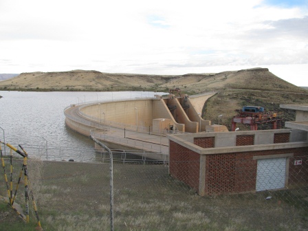
| Clanwilliams Dam wall |
 |
| Teeny`s near miss !! |
 |
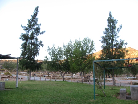
| Springbok caravan park |
 |
| One of the many picnic stops along the main roads in namibia |
 |
| This looks like the place they used for the cover of the eagles CD !! |
 |
| Source of the hot spring in Ai-Ais |
 |
| "Ma-lindi lindi" |
 |
| Canon Roadhouse |
 |
| Nautie Dam |
 |
Camp at Sesriem
|
 |
| The dune we climbed |
 |
| Freestate farmers that gave us a lift to the dunes |
Departure from South Africa into Namibia.
Our trip along the west coast of South Africa continued to be beautiful as we winded our way through the coastal towns of Paternoster, Laaiplek on to Lamberts Bay. We decided to try our hand at making bread this night and were impressed at our skills – and the amount of garlic we consumed with it!! The west coast was quite a chilly for us Durban folk, but the sunsets into the sea continued to be stunning! We left the coastal route and headed into the Northern Cape – amazing drive through the mountains along a well maintained “Cape to Namibia” route. The wine farms along this route all had interesting irrigation systems – we assume from the canal of water that winds its way just off the road. Our last camp spot in South Africa was Springbok Caravan Park. We were surprised how quiet the town was, but realised that this was only because we arrived on Sunday late afternoon. Monday morning was a different story as we tried to finalise our admin requirements with the banks during the hustle and bustle of the town.
We continued heading north towards the Vioolsdrif border into Namibia. The sudden heat wave as we approached the border let us know we were definitely getting closer to Namibia. The South African crossing is before you drive over the magnificent Orange River. Being in no mans land we were a little unsure whether or not you could stop on the bridge to take pictures – in hindsight we probably should have…next time ;) A quick border crossing without any hassles and we were into the first country on our list – so super exciting we kept punching our hands up in the air as we rode along! Thank goodness the road carries on for miles and miles without anyone passing, so we didn’t get any funny looks!
Looking at the map we figured our first stop should be AisAis so we headed along the B1 to the C10 main gravel road heading east. Southern Namibia is beautiful ranging from flat, barren landscapes into huge mountains with interesting geological features. The main ‘C’roads are well maintained gravel surfaces, which took some getting used to after all the tar we travelled through South Africa. The rain we luckily managed to keep missing during this section of the route has been something that happens only every 50 odd years. So we consider ourselves quite lucky in both aspects 1. We miss the rain and 2. We get to see Namibia as it has not been seen for some time.
AisAis is the most southern point of the Fish River Canyon, and you work your way through beautiful passes to the camp site nestled in the mountains. It was killer hot though!! And the highlight waiting for us at the end was the source of a hot spring 65 C. They have used this hot spring to source a ‘spa’ or indoor swimming pool at the Lodge/ Camp site. After setting up camp we treated ourselves to a cool drink from the bar to welcome us into Namibia, and Nick tried the local lager – Taffels – which he believes is very similar to Castle.
We woke to light pitter patter of raindrops on our tent, and decided to pack everything quickly to avoid getting too wet. By the time everything was arranged and Teeny was collecting water for the days ride the heavens opened. Poor Nick was standing under a lonely tree trying not to get too wet. The short storm passed over and we headed along the C10through AisAisgame park turning off onto the C27 – the scenic route along the boundaries of the Fish River Canyon. Troops of babboons were scattered along the route, as well as these massive locust looking things which we learnt are called MalindiLindi. These are the most hard core bugs I have seen to date and they play of a game of “lets all gather in the roads and the moment one is run over they scurry over to eat them!” They also make very loud warning sounds that we can hear over the engines!
We came to a T-junction and to our left was a huge storm and to the right clear sky – so we followed the clear sky route. Turns out the left route would have taken us to the viewpoint of the Fish River Canyon, but with the weather the way it was it was unlikely we would have seen much! So we continued our route passing old stranded trucks disintegrating in the harsh landscape. Suddenly, what seemed out of no-where popped up a place called Canyon Lodge. We stopped in and were amazed at all the historical artefacts are kept in this restaurant lodge. Old cars, motorbikes, tools and the bar is decorated with number plates from just about every country you can think of. Not having eaten yet we ordered a delicious toasted sami and luckily again managed to avoid the large downpour. Chatting to the other tourists passing through, we heard that the road we planned to take through to Naute Dam was closed due to the river crossing. This meant that we had to head back to the main road (B1) onto Keetmanshoop and backtrack to Naute Dam. A quick stop in Keetmanshoop Tourist Information centre, we still weren’t sure if we would be able to camp at Naute Dam. So we found out about alternatives and headed off another 40kms to the Dam. When we arrived we were blown away by how big it was. For those that don’t know, the main reason for visiting this dam is because Teeny’sOupa and Ouma helped build it in the 1970’s. Such a special moment to be at a spot we had been told so much about before heading off on the trip.
A big tourist truck was also camped there for the night and we learnt that they had been travelling for the past 5 months down the West Coast of Africa. They were only half way through their 10 month trip- quite something to be with the same people through those environments for such a long period of time. Apparently the border crossings were quite time consuming and in one spot they had to wait 7 days to get everyone’s visa’s arranged. A hearty pasta meal, and we jumped into bed just before strong winds killed the tourist truck party.
Nick woke up before the sunrise and went fishing, unfortunately or fortunately only catching beautiful pictures of the sunrise. We headed back to Keetmanshoop to get some money and breakfast before taking a long ride along the main road through to Marientale and onto Maltahohe. It was along this road that we approached a very daunting cloud that looked like something out of storm chasers. Hoping we would miss it, the road took some uncanny turns directly at it. So we pulled over at a picnic stop and to the amusement of some truckers hurried to get our rain gear on, only just in the nick of time. We waited out the 5 min storm and headed off into blue skies sweating terribly in our rain suites! Our introduction to Maltahohe was accompanied by a large group of children cheering at us, whilst the other few poked at a dead puffadder on the side of the road. We stopped in at the backpackers for a good nights rest after a long 370km ride.
The tar road out of Maltahohe changed into gravel, and we winded our way through the Zarishoogte pass. As you head into this mountain range the gravel changed into a very red tinge and against the green mountainside looked truly spectacular. Our most exciting point of this stretch was when Nick approached a dip in the road with an oncoming car. He slowed down, and luckily he did because what appeared out of the dust was a very angry 2m Cape Cobra. WOW – what an amazing sighting this golden coloured snake slithered away into the long grass and rocks and was nowhere to be seen after. The drive through to Sesriem reminded us of the Serengheti we have seen on TV long flat stretch of land with mountains forming like a huge pan.
We arrived at Sesriem and immediately started looking for accommodation. As Sesriem is the last spot before entering into Soussusvlei the prices for accommodation are notoriously expensive. We were very surprised and overwhelmed when Willie the manager from Soussesvlei Oasis helped us out with accommodation. After setting camp and taking a dip in the pool we walked across to purchase our permits for the next day, still not knowing how we were going to travel the 65km to the dunes because motorbikes are not allowed past Sesriem and a shuttle service would have cost us R250 each. Lady luck was again on our side when we bumped into a bunch of riders who had just finished the Hoopstad to Soussusvlei Namib Desert Run. We chatted for a bit, and later at our camp site couldn’t believe they came across to offer us a lift to Soussesvlei in the morning. As we made dinner the sun set over the Sesriemmountains and before we knew it the sky was lit with the most spectacular stars we had seen yet. No moon, no pollution just twinkle twinkle little star. We fell asleep that night feeling very grateful for the kind people we had met that day. Very early morning start, we packed up our camp and bikes and made some padkos for the trip in Soussusvlei. We passed through the gates as they opened and from the back of the bakkie watched as the landscape changed from mountains into high sand dunes. Our first stop on the side of the road we noticed a hot air balloon rising in the distance as the sun rose. Although the view from the hot air balloon must be incredible, we’re not sure if you really get to comprehend the size and shapes of the dunes from up there? We ventured deeper into the dunes onto the 4x4 track still amazed by the ever changing colours, shapes and sizes of the dunes. The wind makes the dunes look as if they have been carved with a knife, so smooth with sharp crests, and the shadows from the sun rising enforce the steepness of the slope. In the heart of Soussusvlei the evidence of the rains is clearly visible with lots of soil erosion and fences being washed away and what remains is what looks like a small dam at the base of the dunes. Again we have been told how privileged we are too see this because in some cases even people who live in Namibia have not seen this sight as it occurs so infrequently. We jumped out the bakkie and climbed the dune taking it one step at a time in the fine sand. At the top the view was startling made better by the little lizard we saw! The feeling of serenity and peacefulness was overwhelming. Of course, we decided that the best way down would be to run down the steep side of the dune and we both nearly face planted with the speed you get running down! As we headed out of Soussusvlei we spotted Gemsbok and Springbok in the fields of long grass. Truly a very memorable experience. To Willie from Soussusvlei Oasis thank you from the bottom of our hearts and to the Free State farmers and desert run specialists thank you for making our Soussusvlei experience so special and of course possible!!


Looks amazing guys!! And those bright orange sunset pics with the the grass in the foreground are too stunning for words...
ReplyDeleteNings. x
wow wow wow, I have tears in my eyes reading these stories, what amazing experiences and beautiful things you are seeing! Love you guys and so happy for you to have made this opportunity possible for each other, keep going xxx
ReplyDeletethis is incredible what an adventure!!!! Love you muchly xxxx
ReplyDeleteSo AMAZING!!! What an experience... your pictures are breathtaking..xx
ReplyDelete